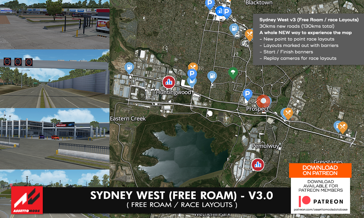
Sydney West v3 (Free Roam / Race Layouts) – Patreon Download
Complete detailed map featuring 130km+ of roads which will keep you driving for hours. Map features carparks, easter eggs, many well known brands / buildings including McDonalds, KFC, 7Eleven, Car yards and more.
————– Map features —————-
Close representation of a real Australian location – Based on parts of the Western Sydney Suburbs, Blacktown, Propsect, Seven Hills, Toongabiee, Greystanes, Wetherill Park Areas
– 130+kms of roads in total
– 5+kms of M4 Motorway now included with dual Service stations at Eastern Creek
– more than 2000 houses throughout map
– carparks, shopping centres, points of interests and more
– Working street / night lights
– Many areas styled closely to Google street view
– AI layouts (traffic layout + race layouts)
Version: v3.0
Country: Australia
Length: 130km
Pit Boxes: 30